Sample output
EP-1 sample data sheet
The sheet from the walkthrough video, exported from the app as a letter-size page. Project details are examples.
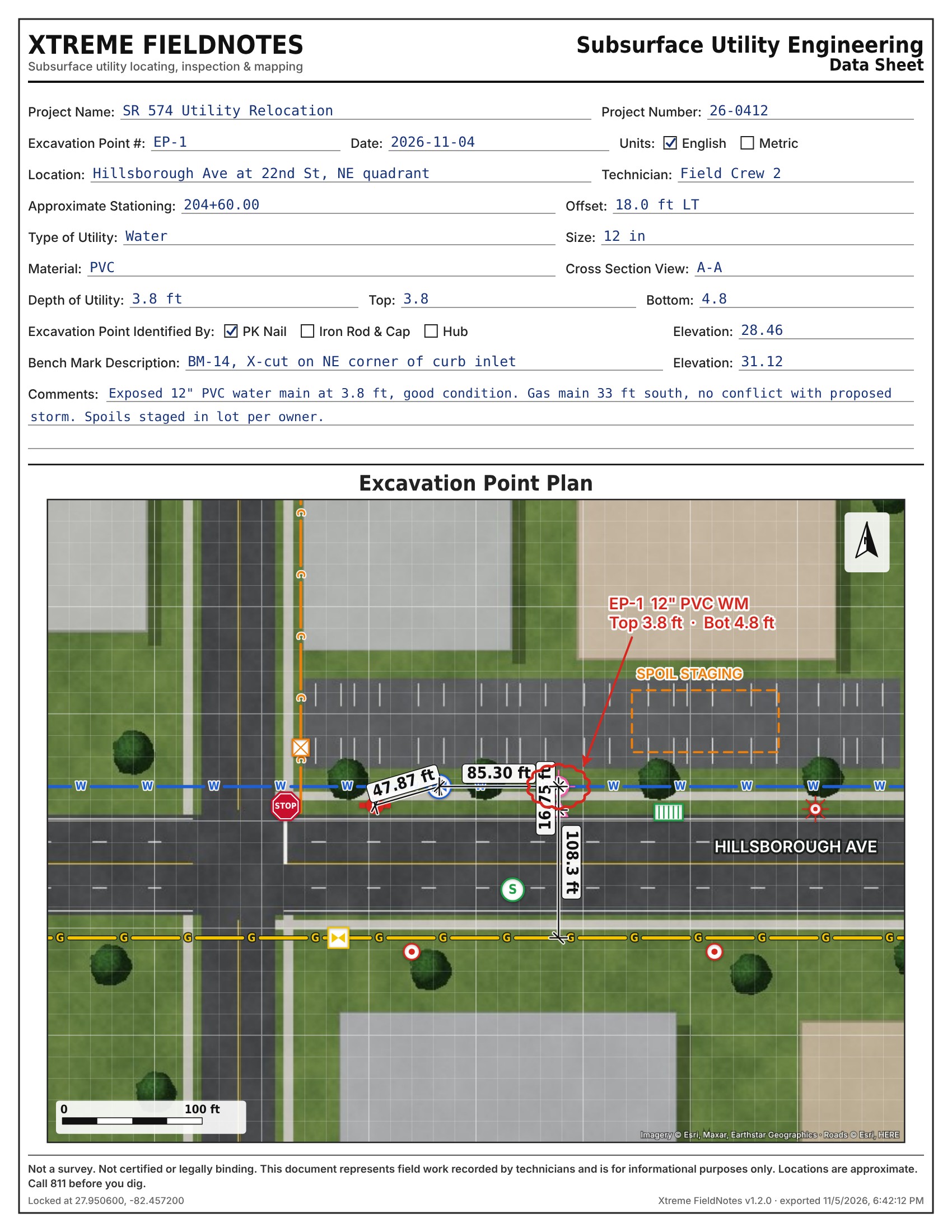
What's on the page
- Data sheet fields. Project, EP number, date, units, location, stationing and offset, utility, size, material, depths, elevations and benchmark.
- How the point is marked. PK nail, iron rod and cap, or hub, checked the same way as the paper form.
- The locked plan. Satellite base with the scale bar, north arrow and lock coordinates.
- Markup. Lettered water, gas and communication lines in APWA colors, symbols, a cloud around the test hole and a callout.
- Dimensions. Hydrant to valve 47.87 ft, valve to test hole 85.30 ft, PK nail offset 16.75 ft, test hole to gas main 108.3 ft.
Disclaimer. This document was generated by the Xtreme FieldNotes app and is provided for informational purposes only. It is not a survey and does not constitute a survey, plat, map, or engineering drawing of any kind. It has not been prepared, reviewed, signed, or sealed by a licensed Professional Surveyor and Mapper or Professional Engineer, and it is not certified and not legally binding in any way.
The information shown is simply a representation of field work and observations recorded by technicians on site. Locations, measurements, depths, markings, and other data are approximate. They may be affected by equipment limitations, site conditions, GPS accuracy, and human error.
This document must not be relied upon for design, construction, excavation, property boundary determination, or any legal purpose. Before any digging, contact 811 to have utilities located. Xtreme App Development and its users assume no liability for decisions made or actions taken based on this document.